
The Everest region – the highest national park in the world, and a World Heritage site.
Overview
Sagarmatha National Park covers the Nepali side of Everest and most of the Khumbu, from about 2,800 metres at Monjo to 8,849 at the summit. It was inscribed as a World Heritage site in 1979.
Above the birch and rhododendron the landscape turns to glacier, moraine and rock, with Everest, Lhotse, Nuptse, Ama Dablam and Cho Oyu around it. Himalayan tahr, musk deer, snow leopard and the Impeyan pheasant all live here, though the last two are rarely seen.
It is also Sherpa country, and the monasteries at Tengboche and Khumjung are as much a part of a visit as the peaks. Entry is on foot from Lukla, or by helicopter.
Itinerary
Day 1 :
Arrive in Kathmandu
You are met at Tribhuvan International and transferred to your hotel in Kathmandu. The afternoon is given to a trek briefing and an equipment check - we go through the route, the acclimatisation profile and the Lukla flight arrangements, and look over your kit. Anything missing can be bought or hired in Thamel the same day, usually more cheaply than at home. Sagarmatha National Park covers the Nepali side of Everest and the whole of the Khumbu, running from about 2,800m at the park gate to 8,849m at the summit; it was inscribed as a World Heritage site in 1979. The evening is yours.
Day 2 :
Fly to Lukla and trek to Phakding
The flight to Lukla is short, spectacular and weather-dependent - thirty-five minutes from Kathmandu or a little less from Ramechhap, landing on a 527-metre runway cut into the hillside at 2,840m with a gradient built in to slow the aircraft down. From the airstrip we walk, and the first afternoon is deliberately easy: a gentle descent down the Dudh Koshi through Chheplung and Ghat to Phakding at 2,610m, two to three hours with the river below and prayer walls and mani stones beside the trail. Losing height on day one is intentional and helps you sleep. Overnight in a lodge by the river.
Day 3 :
Phakding to Namche Bazaar
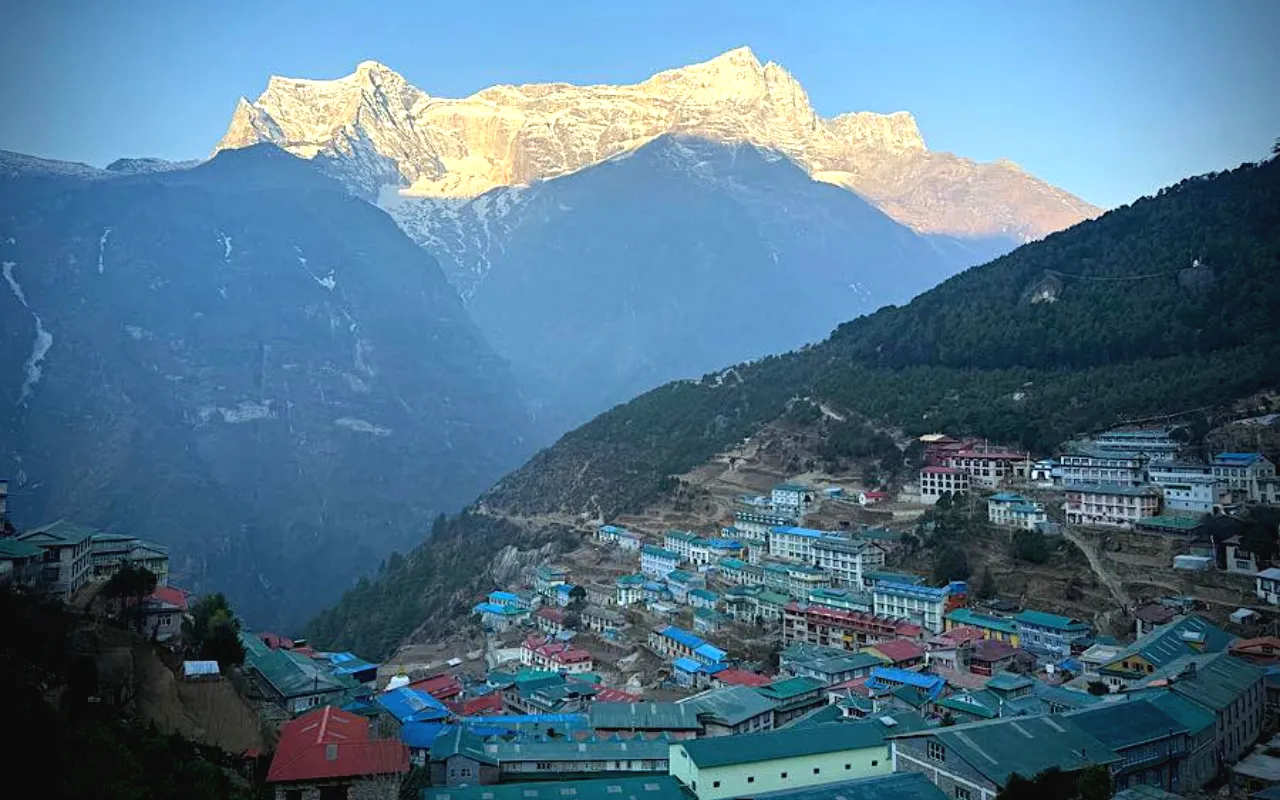
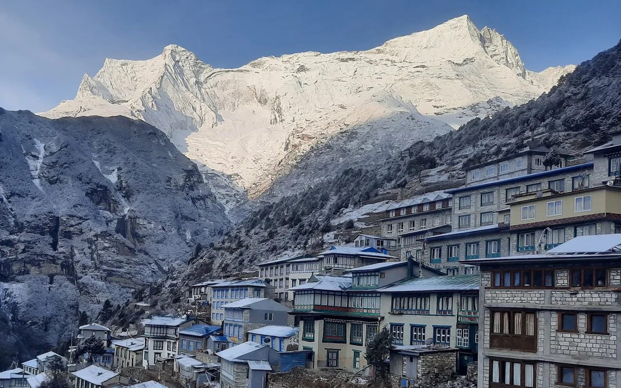
A long day, and the one that takes you into the park proper. We follow the Dudh Koshi north, crossing it several times on high suspension bridges strung with prayer flags - the Hillary Bridge above the confluence with the Bhote Koshi is the highest and the one everybody photographs. The park entrance is at Monjo, where permits are checked. From the bridge the trail climbs steeply for two hours to Namche Bazaar at 3,440m, and there is a point on the way up where Everest first appears over the Nuptse-Lhotse wall. Namche sits in a natural amphitheatre and is the Sherpa capital and the last real town on the route - bakeries, gear shops, ATMs and lodges stacked up the hillside.
Day 4 :
Acclimatisation day at Namche
An acclimatisation day, which does not mean a rest day. The rule is to climb high and sleep low, so we walk up to the Everest View Hotel at 3,880m for the view of Everest, Lhotse and Ama Dablam over breakfast, then on to Khumjung and Khunde - working Sherpa villages with the school and hospital Edmund Hillary helped found, and the Khumjung gompa with its supposed yeti scalp. Coming back down to sleep at Namche is what makes the rest of the trek possible. If the day falls right, the Saturday market brings traders up from the lower valleys and is worth an hour. The Sherpa culture museum above the town is also good.
Day 5 :
Namche to Tengboche
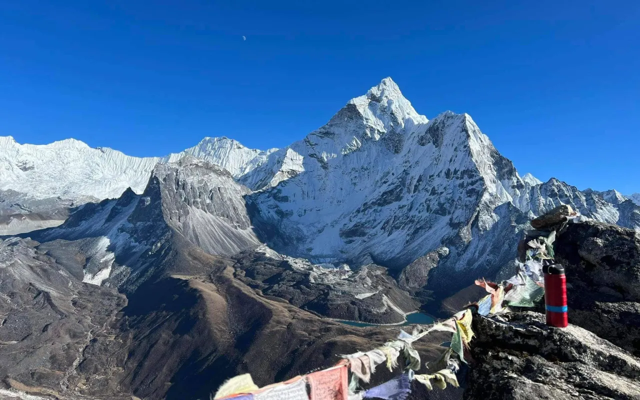
We contour along the valley wall out of Namche with Ama Dablam ahead - at 6,812m it is the most photographed mountain in the Khumbu and from this angle it is genuinely startling. The trail runs level for two hours to Kyangjuma, then drops sharply to the Dudh Koshi at Phunki Tenga, and climbs steadily for two hours through rhododendron and birch to Tengboche at 3,860m. The monastery there is the spiritual centre of the Khumbu, rebuilt after a fire in 1989, and afternoon prayers are open to visitors - the sound of the horns and the chanting with Everest and Ama Dablam behind the building is one of the things people remember longest.
Day 6 :
Tengboche to Dingboche
Down through the forest to Deboche and across the Imja Khola, then up past Pangboche - the oldest gompa in the Khumbu - and into open country. The treeline is behind you now and the landscape becomes juniper scrub, moraine and rock, with the peaks much closer on both sides. It is five to six hours to Dingboche at 4,410m, a summer settlement in the Imja valley with stone-walled potato fields and lodges strung along the flat. The air is noticeably thinner here and most people feel it. Evenings are cold and the lodges heat one room with a yak-dung stove.
Day 7 :
Acclimatisation day at Dingboche
A second acclimatisation day, spent going up and coming back down. The walk up Nangkartshang above the village takes two to three hours and reaches around 5,000m, with the reward being Makalu at 8,485m to the east, Lhotse and the Imja valley running up to Island Peak, and Ama Dablam from behind. It is a real climb and it will feel hard, which is the point - the effort at altitude is what drives the acclimatisation. We come back to Dingboche for lunch and spend the afternoon resting, drinking and eating, all three of which matter more than most people expect.
Day 8 :
Dingboche to Lobuche
Up the valley to Dughla, then the steep pull to the Thukla pass at 4,830m, where a long line of stone memorials stands to climbers who have died on Everest - among them Scott Fischer and Babu Chiri Sherpa. It is a sobering half-hour and the place where the scale of what you are walking towards becomes obvious. From the pass the trail follows the lateral moraine of the Khumbu glacier to Lobuche at 4,940m, a cluster of lodges in a bleak spot with Nuptse rising directly above. Five to six hours in total. It is cold, the air is thin, and appetite starts to go - eating anyway is part of the job.
Day 9 :
Lobuche to Gorak Shep and Everest Base Camp
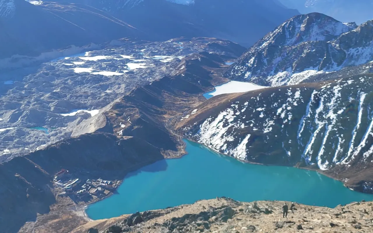
The long day. We follow the Khumbu glacier moraine to Gorak Shep at 5,164m, two to three hours over loose rock with the ice on your right, and stop for an early lunch. From there it is another two to three hours out to Everest Base Camp at 5,364m across the glacier itself - a chaos of moraine, ice pinnacles and meltwater. In the spring climbing season the camp is a small town of tents at the foot of the Khumbu icefall; outside it, the site is just ice and prayer flags, and the mountain is hidden behind Nuptse from here. Either way, standing at the foot of the icefall is why people come. We return to Gorak Shep for the night, which is a hard, cold one at that altitude.
Day 10 :
Kala Patthar and down to Pheriche
Up in the dark for Kala Patthar at 5,545m, the highest point of the trek and a steep hour and a half of walking that feels considerably longer. It gives the best view of Everest available from the Nepal side - the whole south-west face, with Nuptse, Changtse and Pumori around it - and the sunrise on it is the single image most people take away. Afterwards we descend, and losing altitude fast is an enormous relief: back past Lobuche and Thukla and down to Pheriche at 4,240m, where the Himalayan Rescue Association clinic runs afternoon talks on altitude sickness that are worth attending.
Day 11 :
Pheriche to Namche and on to Lukla
A long descent, retracing the route down through Pangboche, Tengboche and Kyangjuma to Namche, then the steep drop to the river and the walk back through Monjo and Phakding to Lukla. It is condensed into two long but straightforward days, and going downhill at these altitudes with a thickening atmosphere is a completely different experience from the climb. Appetite comes back, sleep improves, and the forest and birdsong return below Tengboche. The last evening in Lukla is traditionally spent with the crew.
Day 12 :
Fly Lukla to Kathmandu
The Lukla flight leaves early, before the cloud builds in the valley, and takes thirty-five minutes back to Kathmandu or Ramechhap. Delays and occasional cancellations are normal here and we never book an international flight for the same day - a spare day in Kathmandu at the end of a Khumbu trek is not optional. Once back you are transferred to your hotel, and there is a farewell dinner in the evening.
Cost
The Cost Includes
- 2 nights twin-sharing hotel accommodation in Kathmandu with breakfast
- Teahouse and lodge accommodation for 10 nights on the trail
- All meals on trek - 10 breakfasts, lunches and dinners, with tea or coffee
- Government-licensed trekking guide, and one porter between two trekkers
- Guide and porter wages, insurance, equipment, food and accommodation
- All trekking permits, TIMS card and national park or conservation area fees
- Ground transport to and from the trailhead
- Purified drinking water on trek, by filter or purification tablets
- Basic first-aid kit and a pulse oximeter carried by the guide
- Farewell dinner in Kathmandu
The Cost Excludes
- Domestic flights where the itinerary uses them, quoted separately
- Lunches and dinners in Kathmandu
- Hot showers, battery charging and Wi-Fi at teahouses
- Bottled or boiled water, and all other drinks
- Personal trekking equipment and clothing
- Extra nights in Kathmandu caused by an early return or a flight delay
- International flights to and from Nepal
- Nepal entry visa (USD 30 for 15 days, USD 50 for 30 days, USD 125 for 90 days, on arrival at Kathmandu airport)
- Travel and medical insurance, including emergency evacuation cover
- Personal expenses - laundry, phone calls, bar bills and shopping
- Tips for your guide and driver
- Anything not listed under "The Cost Includes"