


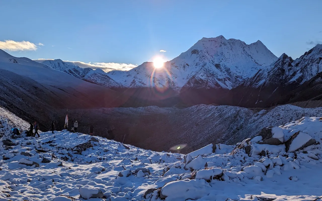
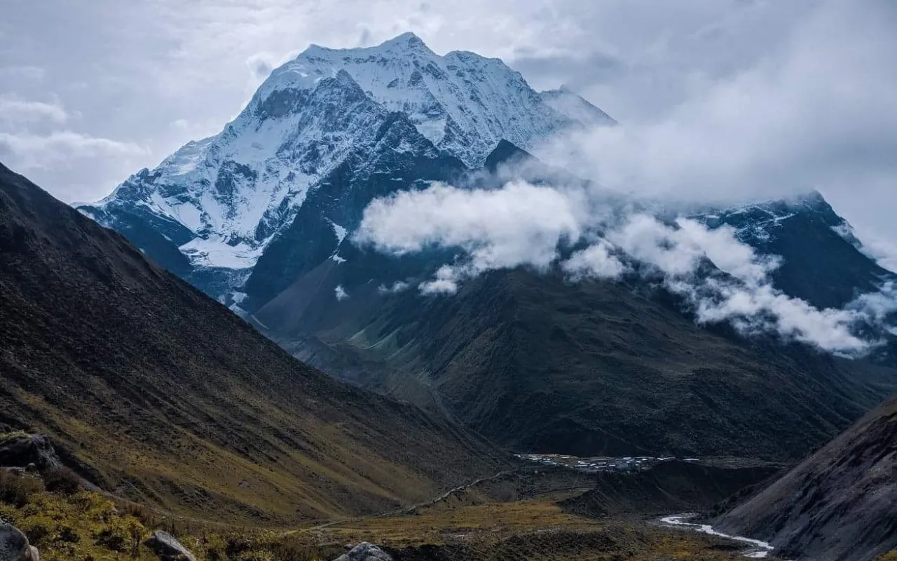
A high grazing valley in Baglung, between the Dhaulagiri massif and the western hills.
Overview
Dhorpatan is a broad, open valley at around 3,000 metres, used for generations as summer grazing and now the centre of Nepal’s only hunting reserve. The trek reaches it through Baglung and Burtibang, climbing out of the middle hills into alpine meadow and pine.
The walking is remote rather than technical. There are few teahouses, so trips here are usually run camping, with the Dhaulagiri range to the north and blue sheep on the slopes above the valley.
It suits walkers who have done a teahouse trek and want somewhere with no crowd at all.
Itinerary
Day 1 :
Arrive in Kathmandu
You are met at the airport and transferred to your hotel. The afternoon briefing covers the route, the permits - Dhorpatan needs a hunting reserve entry permit as well as the usual paperwork, and it takes longer to arrange than a teahouse trek - and the kit list. This is a camping trek, so the load is different: the crew carries tents, kitchen and food, but you need a proper sleeping bag and warm layers for nights above three thousand metres. Anything missing can be bought or hired in Thamel the same afternoon.
Day 2 :
Kathmandu to Pokhara
We travel to Pokhara, either on the twenty-five minute flight or by road in six to seven hours along the Trishuli and Marsyangdi rivers. The drive is slower but shows you the middle hills properly - terraced farmland, river confluences and roadside towns - while the flight gives you the Himalaya along the whole northern horizon. Pokhara sits at 800m beside Phewa Lake with Machhapuchhre almost 7,000m directly above it, and the afternoon is free at Lakeside. It is worth an early night: tomorrow is a long day in a vehicle.
Day 3 :
Pokhara to Beni and on to Darbang
West by road along the Kali Gandaki to Beni, a market town at the confluence of the Kali Gandaki and the Myagdi Khola, and then onto a rougher road that follows the Myagdi upstream to Darbang at about 1,110m. The second half of the drive is slow and bumpy, on a road cut into the hillside above the river, and takes most of the day in total. Darbang is the road head and the start of the walking. The crew sorts loads here and we camp on the flat ground by the river, or take rooms in the small lodge if it is available.
Day 4 :
Darbang to Dharapani
The walking begins. We follow the Myagdi Khola and then climb away from it through Magar villages and terraced hillside, gaining height steadily all morning. Magar are the largest of Nepal's indigenous hill peoples and this is their heartland - the houses are stone with slate roofs, and the terracing on these slopes is some of the most impressive in the country. It is five to six hours to Dharapani at around 1,500m, with a stop for lunch on the way. Camp is set on a terrace with the valley falling away below.
Day 5 :
Dharapani to Muna
A steady climb through oak and rhododendron forest, which in March and April is in full flower and turns the whole hillside red and pink. As we gain height the trees thin and Dhaulagiri begins to show itself to the north - at 8,167m the seventh-highest mountain in the world, and from here it dominates everything. The day is about six hours with a good deal of ascent, so the pace is deliberate. Muna is a Magar village at around 1,900m with a school and a handful of houses, and camp is pitched just beyond it.
Day 6 :
Muna to Lumsum
A shorter and gentler day, climbing to around 2,200m through summer grazing settlements and the last of the permanent farmland. The trail passes through goths - temporary stone shelters used by herders bringing buffalo and goats up for the season - and the forest becomes more open. Four to five hours of walking leaves the afternoon free, which matters because tomorrow is the hardest day of the trek. Lumsum is little more than a clearing with water. The evening is cold enough for a fire.
Day 7 :
Lumsum to Moreni via the Jaljala pass
The crossing, and the day the trek is built around. We climb steadily all morning to the Jaljala pass at 3,414m, a broad open saddle of alpine meadow rather than a narrow col, hung with prayer flags and looking north to the entire Dhaulagiri massif standing above the valley. It is a long ascent - six to seven hours in total including the descent - and the altitude is noticeable for the first time. From the top the trail drops onto the northern side into open grazing country, and the character of the trek changes completely: no more forest, no more villages, just meadow and sky. Camp at Moreni.
Day 8 :
Moreni to Dhorpatan
A short day down into the Dhorpatan valley itself, a broad flat-bottomed basin at about 2,900m that has been used as summer grazing for generations. After the enclosed forest of the walk in, the openness is startling - the valley runs for several kilometres with the river braiding across the middle of it and the mountains standing back on either side. There is a Tibetan settlement here, established after 1959, with a small monastery and a carpet-weaving tradition. Three to four hours of easy walking brings us in, and camp is set on the valley floor.
Day 9 :
Exploring Dhorpatan
A full day in the valley with no walking obligation. Dhorpatan is the centre of Nepal's only hunting reserve, about 1,325 square kilometres spread across Baglung, Myagdi and Rukum on the southern flank of Dhaulagiri, and the wildlife is the reason it was protected: blue sheep and Himalayan tahr are commonly seen on the slopes above the valley, and snow leopard, musk deer, red panda and wolf all live here though you are unlikely to see them. We walk up onto the shoulder above the camp for the view and the animals, visit the Tibetan settlement, and spend the rest of the day at the pace you want. This is the emptiest place most people will ever walk in.
Day 10 :
Dhorpatan to Nisi Khola
We begin the walk out, descending the southern side of the valley towards the Nisi Khola. The trail drops steadily out of the alpine zone and back into scrub and then forest, and the temperature climbs with every hour. It is five to six hours of mostly downhill walking, which is easier on the lungs and harder on the knees. Camp is beside the river, low enough that the evening is mild for the first time in several days.
Day 11 :
Nisi Khola to Gurjaghat
Through forest and Magar farming settlements, following the river down and losing height steadily. The terracing reappears, then the villages, then the mule trains, and by the middle of the afternoon you are back among people. Five to six hours. Gurjaghat is a small settlement with water and flat ground. This and the following day are the reverse of the walk in, but the country reads completely differently going downhill and in the opposite light.
Day 12 :
Gurjaghat to Darbang
The last full walking day, dropping back to the road head at Darbang along the Myagdi Khola. Five hours or so, mostly descending, through the villages we passed on the way up. There is usually a good deal of ceremony at the end of a camping trek - the crew have carried everything you have used for eight days - and the last evening is generally spent with them rather than apart from them. Camp or lodge at Darbang.
Day 13 :
Darbang to Pokhara
By road back down the Myagdi valley to Beni and then east along the Kali Gandaki to Pokhara, five to six hours in total on a road that improves markedly in the second half. You arrive in the afternoon with time for the thing everybody wants after a fortnight of camping, which is a hot shower and a proper meal. The evening is free at Lakeside, and the Annapurnas you have been walking beneath are visible from the lake.
Day 14 :
Pokhara to Kathmandu
Fly or drive back to Kathmandu - the flight takes twenty-five minutes and the road six to seven hours, and after this trek most people take the flight. The afternoon is free for shopping in Thamel or simply for doing nothing. We have a farewell dinner in the evening, usually somewhere with Nepali food and music, and go through the practicalities of your onward flight.
Cost
The Cost Includes
- 2 nights twin-sharing hotel accommodation in Kathmandu with breakfast
- Full camping support for 11 days - two-person tents, dining and toilet tents, mattresses and all kitchen equipment
- All meals on trek - 11 breakfasts, lunches and dinners, with tea or coffee
- Government-licensed trekking guide, and one porter between two trekkers
- Guide and porter wages, insurance, equipment, food and accommodation
- All trekking permits, TIMS card and national park or conservation area fees
- Ground transport to and from the trailhead
- Purified drinking water on trek, by filter or purification tablets
- Basic first-aid kit and a pulse oximeter carried by the guide
- Farewell dinner in Kathmandu
The Cost Excludes
- Domestic flights where the itinerary uses them, quoted separately
- Lunches and dinners in Kathmandu
- Hot showers, battery charging and Wi-Fi at teahouses
- Bottled or boiled water, and all other drinks
- Personal trekking equipment and clothing
- Extra nights in Kathmandu caused by an early return or a flight delay
- International flights to and from Nepal
- Nepal entry visa (USD 30 for 15 days, USD 50 for 30 days, USD 125 for 90 days, on arrival at Kathmandu airport)
- Travel and medical insurance, including emergency evacuation cover
- Personal expenses - laundry, phone calls, bar bills and shopping
- Tips for your guide and driver
- Anything not listed under "The Cost Includes"