
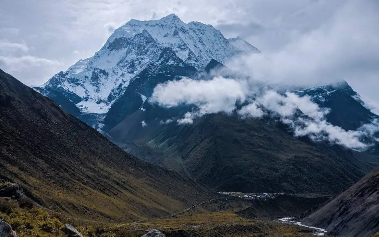

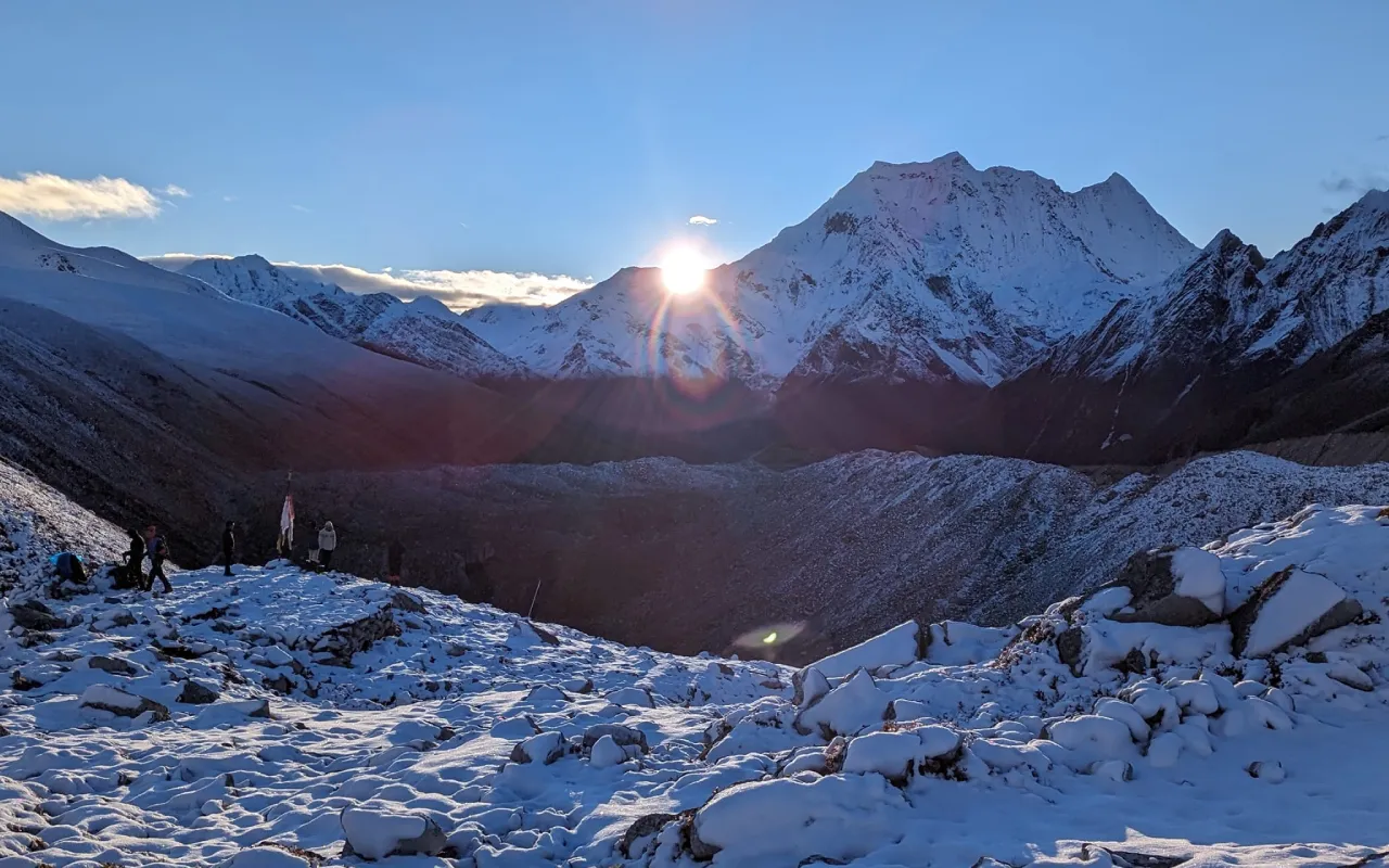

A park with no roads and almost no visitors, next to Everest.
Overview
Makalu Barun protects about 1,500 square kilometres east of Sagarmatha, running from around 400 metres in the Arun valley to Makalu at 8,485 – one of the greatest altitude ranges of any protected area on earth.
That range gives it extraordinary biodiversity: subtropical forest, temperate oak and rhododendron, alpine meadow and glacier, with red panda, snow leopard, clouded leopard and more than four hundred bird species.
The Barun valley is one of the most remote places in Nepal that can be walked to. Trips here are camping expeditions, not teahouse treks.
Itinerary
Day 1 :
Arrive in Kathmandu
You are met at the airport and transferred to your hotel. The briefing for this trek is a long one: Makalu Barun is a full camping expedition with no teahouses beyond the lower villages, no roads, and no realistic evacuation options once you are in the Barun valley beyond helicopter. We go through the route, the crew, the food arrangements and the kit list in detail, and check your equipment properly. The park protects about 1,500 square kilometres east of Sagarmatha and runs from around 400m in the Arun valley to 8,485m at the summit of Makalu - one of the greatest altitude ranges of any protected area on earth.
Day 2 :
Fly Kathmandu to Tumlingtar
The flight to Tumlingtar takes about forty-five minutes and lands in the Arun valley at roughly 400m - the lowest start of any Himalayan trek in Nepal, and the reason this route takes as long as it does. It is hot, humid and green, with banana and rice on the terraces and the Arun running broad and brown below the strip. The afternoon is spent organising loads and porters. Overnight in Tumlingtar, and it is worth appreciating the temperature now, because it will not be like this again for a fortnight.
Day 3 :
Tumlingtar to Chichila
By road up the ridge from Tumlingtar to Chichila at about 1,980m, two to three hours on a rough track that climbs steadily out of the valley heat. The change in vegetation over sixteen hundred metres of ascent is dramatic - from subtropical to temperate in an afternoon. Chichila is a Gurung village strung along the ridge with views opening north. Camp on the flat ground above the village; the evening is cool for the first time.
Day 4 :
Chichila to Num
Along the ridge with the first proper views of Makalu ahead and the Arun valley falling away on both sides, then a descent towards Num at about 1,500m. The walking is four to five hours and the trail passes through Rai and Gurung villages with terraced fields on impossibly steep ground. Num sits on a spur above the confluence, and from the camp you can see tomorrow's route: down to the river and straight up the other side, which is a sobering thing to look at over dinner.
Day 5 :
Num to Seduwa
The hardest day of the approach and one of the biggest single descents and ascents on any Nepali trek. We drop about eight hundred metres to the Arun at 700m - steep, hot and hard on the knees - cross the suspension bridge, and then climb roughly the same again to Seduwa at 1,500m on the far side. It takes six to seven hours and the middle of it is genuinely uncomfortable in the heat. Seduwa is a scattered Rai village with a school and a health post. The reward is that the worst of the approach is now behind you.
Day 6 :
Seduwa to Tashigaon
A steadier day, climbing through Rai villages and terraced fields to Tashigaon at about 2,100m, the last permanent settlement on the route and the point at which we enter the park proper. Four to five hours. Tashigaon is Sherpa and Rai and has a handful of houses, a gompa and the last shops; from here to the Barun valley and back there is nothing at all. The crew reorganises here and porters are sometimes changed. Camp above the village.
Day 7 :
Tashigaon to Khongma Danda
The climb that everybody remembers. From Tashigaon the trail goes up, relentlessly, through dense rhododendron and oak forest to Khongma Danda at about 3,500m - fourteen hundred metres of ascent in five to six hours with almost no respite. In spring the rhododendron is in full flower along the whole climb, which helps. Khongma Danda is an exposed ridge with a few stone shelters and, if the cloud lifts, a view back over the entire Arun valley. It is cold and often wet.
Day 8 :
Acclimatisation at Khongma Danda
A rest and acclimatisation day at Khongma Danda, which is not optional - the next three days cross passes above four thousand metres and the gain from Tashigaon has been rapid. We take a short walk higher up the ridge in the morning for the acclimatisation benefit and the view, then come back down to camp. The rest of the day is spent eating, drinking and resting. In clear weather Makalu, Chamlang and the Kanchenjunga massif are all visible from the ridge above camp.
Day 9 :
Khongma Danda to Dobato
The pass day. We cross the Shipton La at 4,216m and then the Keke La, on a trail that undulates between small frozen lakes and rocky saddles with Chamlang and Peak 6 ahead. It is six to seven hours of hard walking at altitude and the weather here is genuinely unpredictable - snow is possible at any time of year. From the last pass the trail drops steeply into the Barun valley, and the first view down into it is one of the great sights of the eastern Himalaya. Camp at Dobato.
Day 10 :
Dobato to Yangle Kharka
Down into the Barun valley proper, losing height through birch and rhododendron to the valley floor at Yangle Kharka, around 3,600m. The Barun is a deep glacial trench with rock walls thousands of feet high on both sides and waterfalls coming off them, and it is one of the most remote places in Nepal that can be reached on foot. Five to six hours. Red panda, musk deer and Himalayan tahr live here, and the valley has over four hundred recorded bird species across its altitude range.
Day 11 :
Yangle Kharka to Langmale Kharka
Up the valley past waterfalls and summer grazing settlements to Langmale Kharka at about 4,410m, five hours or so with a steady gain. The vegetation thins to juniper scrub and then to alpine meadow, and the peaks close in on both sides - Peak 6, Peak 7 and Chamlang above the valley walls. Yak herders bring animals up here in summer and the stone goths are still in use. It is cold at night now and the pace is deliberately slow.
Day 12 :
Langmale Kharka to Makalu Base Camp
The last climb, up the valley to Makalu Base Camp at about 4,870m, four to five hours over moraine and glacial debris. Makalu itself, at 8,485m the fifth-highest mountain in the world, stands directly above the camp - a black pyramid of extraordinary steepness that looks its height in a way few eight-thousanders do. The camp is a flat area of moraine used by expeditions in season and empty the rest of the year. Arriving here after eleven days of walking, with nobody else in the valley, is the point of the whole trek.
Day 13 :
Makalu Base Camp
A full day at base camp. The walk up onto the Barun glacier and towards the Sherpani Col takes you to a viewpoint from which Everest and Lhotse are visible from the east - the Kangshung side, a face that very few people ever see and that is quite unlike the familiar profile from the Khumbu. It is four to five hours out and back at nearly five thousand metres, so it is hard work, and it is the single best day of the trek. Those who would rather rest can spend the day at camp with Makalu above them.
Day 14 :
Base camp to Yangle Kharka
The walk out begins, back down the valley to Yangle Kharka, five to six hours of straightforward descent with the whole valley opening ahead of you. Losing altitude after four days above four thousand metres is an immediate physical relief - sleep and appetite both return the same night. The light in the Barun in the afternoon, coming down the valley rather than up it, is quite different.
Day 15 :
Yangle Kharka to Dobato
Back up towards the passes, climbing out of the Barun to Dobato in five to six hours. This is the one significant reascent of the return and it is hard work at the end of a long trek, though by now you are thoroughly acclimatised and it will feel easier than the same ground did on the way in. The valley falls away behind you as you climb, and the last views back up the Barun towards Makalu come on this stretch rather than at the pass itself, so it is worth stopping for them. Camp at Dobato with the two passes ahead for the morning, and an early night - tomorrow is the longest day of the return.
Day 16 :
Dobato to Tashigaon
Over the Keke La and the Shipton La and down the long descent to Tashigaon, seven hours or so and a substantial day. The forest returns below Khongma Danda, and with it the birdsong, the warmth and the first houses in over a week. Reaching a permanent village after that stretch of country is a considerable thing. Camp above Tashigaon.
Day 17 :
Tashigaon to Num and drive to Tumlingtar
The last of the walking: down through Seduwa, the drop to the Arun and the climb to Num, which is as hard in this direction as it was in the other and considerably hotter. From Num a vehicle takes us back down the ridge to Tumlingtar. It is a long day in total and it ends in the valley heat you left a fortnight ago. The final evening is spent with the crew, who by this point will have carried, cooked and looked after you for seventeen days.
Day 18 :
Fly Tumlingtar to Kathmandu
The morning flight from Tumlingtar to Kathmandu takes about forty-five minutes and runs west along the front of the range, so on a clear day you get Makalu, Everest and Kanchenjunga from the air after eighteen days of seeing them from below. As with all internal flights in eastern Nepal it depends entirely on the weather, and a delay of a day is a normal risk rather than an exceptional one - which is why we never book an international connection for the same evening. You are transferred to your hotel on arrival and the afternoon is free. There is a farewell dinner with the crew in the evening, and it is customary to settle tips then rather than at the airport.
Cost
The Cost Includes
- 2 nights twin-sharing hotel accommodation in Kathmandu with breakfast
- Full camping support for 15 days - two-person tents, dining and toilet tents, mattresses and all kitchen equipment
- All meals on trek - 15 breakfasts, lunches and dinners, with tea or coffee
- Government-licensed trekking guide, and one porter between two trekkers
- Guide and porter wages, insurance, equipment, food and accommodation
- All trekking permits, TIMS card and national park or conservation area fees
- Ground transport to and from the trailhead
- Purified drinking water on trek, by filter or purification tablets
- Basic first-aid kit and a pulse oximeter carried by the guide
- Farewell dinner in Kathmandu
- Makalu Barun National Park entry permit
The Cost Excludes
- Domestic flights where the itinerary uses them, quoted separately
- Lunches and dinners in Kathmandu
- Hot showers, battery charging and Wi-Fi at teahouses
- Bottled or boiled water, and all other drinks
- Personal trekking equipment and clothing
- Extra nights in Kathmandu caused by an early return or a flight delay
- International flights to and from Nepal
- Nepal entry visa (USD 30 for 15 days, USD 50 for 30 days, USD 125 for 90 days, on arrival at Kathmandu airport)
- Travel and medical insurance, including emergency evacuation cover
- Personal expenses - laundry, phone calls, bar bills and shopping
- Tips for your guide and driver
- Anything not listed under "The Cost Includes"